Water Resources Conference Session: Assessing BMP Effectiveness for Water Quality Outcomes with Remote Sensing
Virtually everyone in Minnesota and bordering states whose profession has a direct stake in Water Conservation assembled in Downtown St. Paul’s RiverCentre October 17-18 for the annual Water Resources Conference. I had the honor of chairing a Special Session at the conference titled “Assessing BMP Effectiveness for Water Quality Outcomes with Remote Sensing.” The session featured two very foundational efforts that we are attempting to bridge together in partnered research at GEMS: (1) The Minnesota Department of Agriculture’s (MDA) Minnesota Agricultural Water Quality Certification Program (MAWQCP), directed by Brad Jordahl Redlin, and (2) the Department of Forest Resources’ remote-sensed Water Quality assessment for our 10,000+ lakes, led by Leif Olmanson.
The 90-minute session was organized so that each of the three speakers (one had dropped out last minute for logistical reasons) had 20 minutes to speak plus two minutes for burning questions. At the end the audience had 15 minutes for questions with the entire panel of speakers. There were about 30 very inquisitive people in the audience, who peppered the speakers with questions throughout.
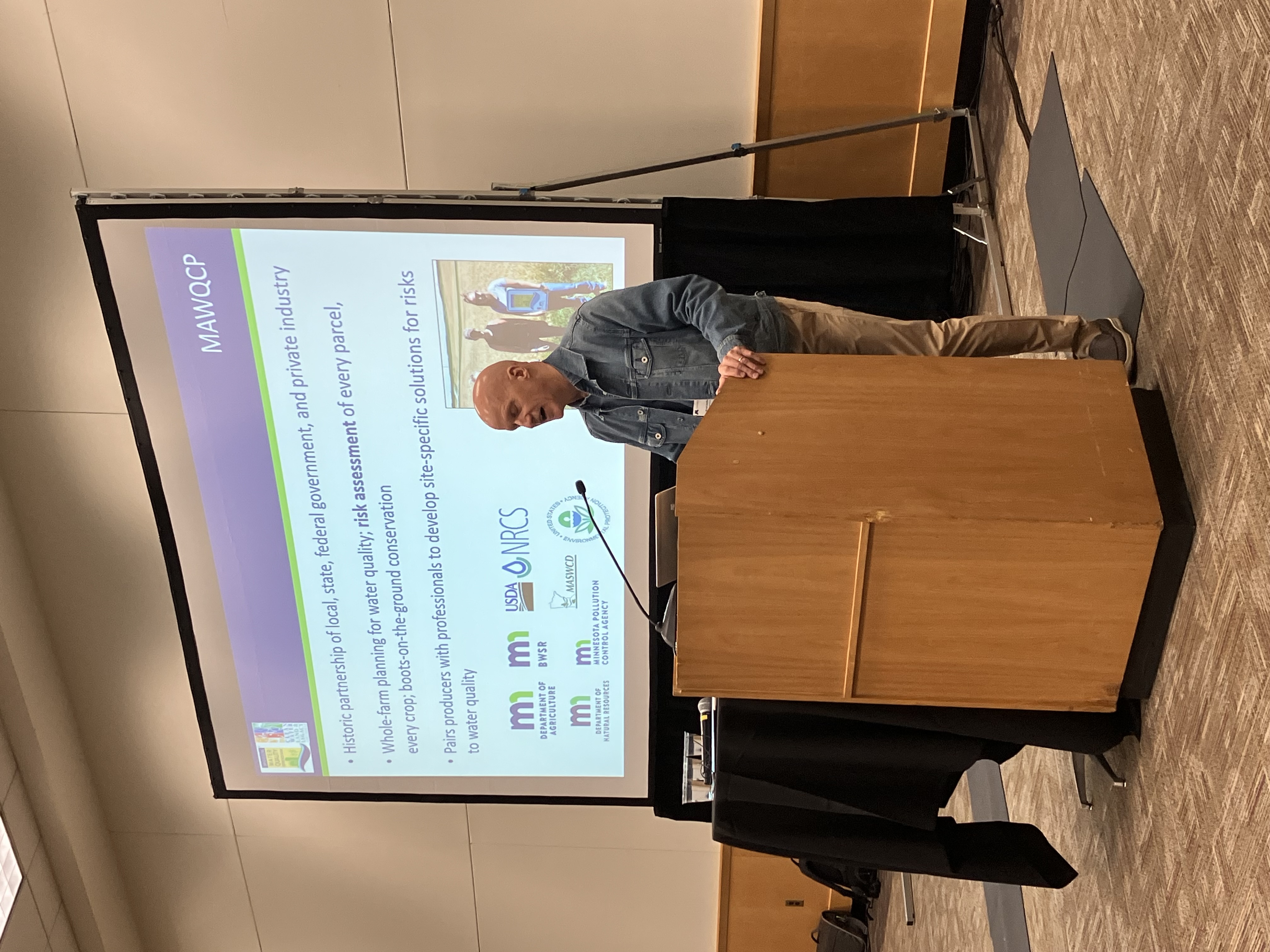
Updates on the MDA’s certification program
Brad Jordahl Redlin kicked off the session with an outstanding talk that outlined the principles on which the certification program he founded and directs was created, and highlighted the progress that has been made. Literally over a million acres have now been certified, spread across over 1400 producers. In exchange for regulatory certainty for a period of time, these producers allow his government agency to (1) assess their farm practices, (2) suggest new management practices (sometimes with additional incentives such as subsidized equipment from a grant), and (3) carry out audits of their new practices. The program, which has been operational for nearly a decade, is well beyond the stage of corralling early-adopters. New participants span the spectrum of producer demographics in age, farm size, and more.
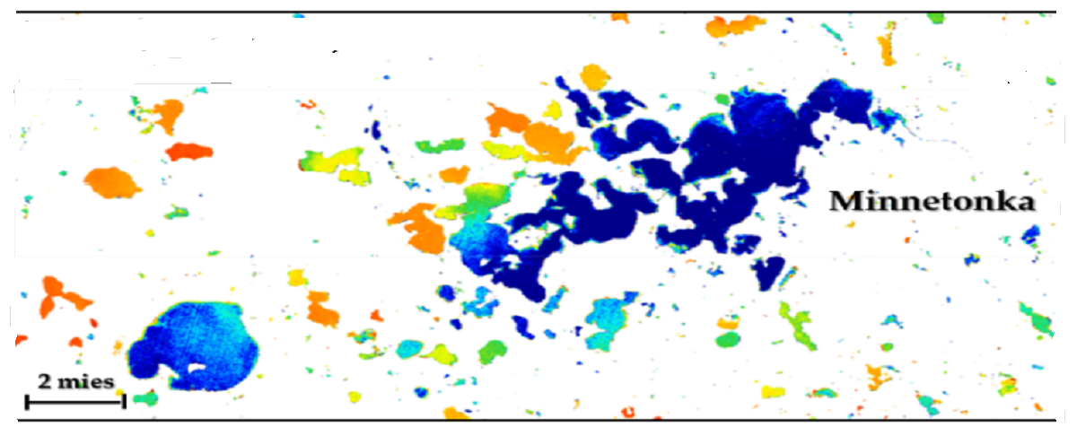
Scaling lake quality measurement
Leif Olmanson stepped up to review an activity that he first spearheaded twenty years ago – using remote sensing to measure the water quality of Minnesota lakes. In the interim, he has overseen steady progress using new generations of satellites (from Landsat to Sentinel), multiple metrics (clarity, chlorophyll, organic matter), and the frequency of data reporting (from once every 5 years to ~weekly lake snapshot and monthly pixel-level composites of all 10,000+ lakes). Data is made available to the casual user via a friendly Lake Browser interface, and in numeric form pixel-by-pixel for data wizards on GEMS Exchange.
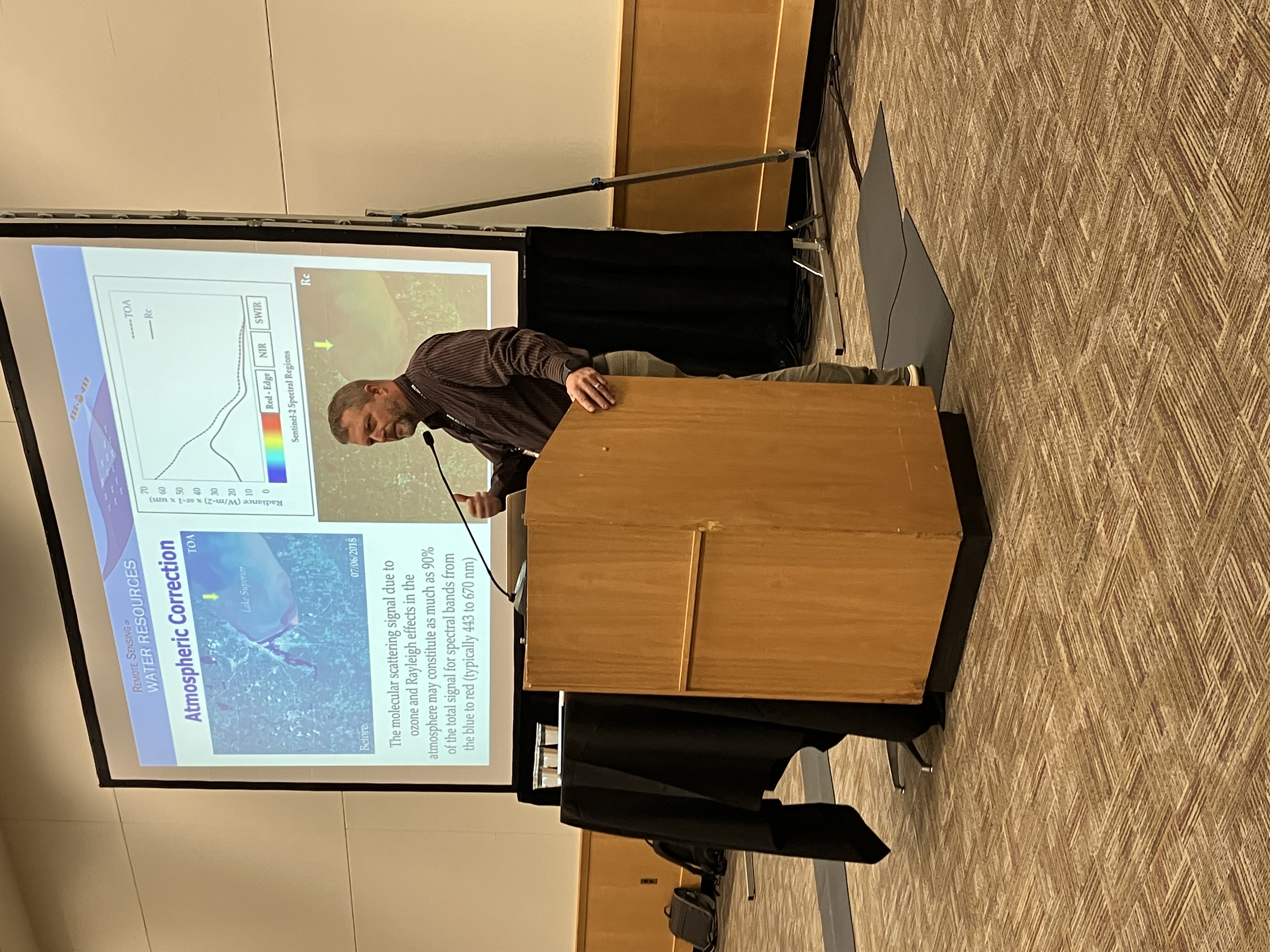
GEMS bridging the two programs
David Porter rounded out the session discussing the improvements he has made in creating algorithms that properly remove clouds and aerosols from the satellite images. This is a prerequisite for feeding all of the regularly spaced (~5 day) images of a field through a growing season into a sophisticated Recurrent Neural Network (RNN, a type of Machine Learning algorithm) that his colleague Anubha Agrawal has been preparing. As described in this case study, David, Anubha, and I intend to use the RNN trained on known, certified management practices (e.g., strip till / no till, cover crops) from the MAWQCP to make a prediction of what practices growers are making on uncertified farmland. We then will trace these producer fields to the downstream lakes in each watershed, and see what covariates (e.g., slope, soil type, distance to waterway) affect the correlation of % farm practice adoption vs. downstream lake quality in a watershed.