Exchange API's

GEMS Exchange APIs

A GROWING PORTFOLIO OF INTEROPERABLE STREAMING SERVICES

AN OVERVIEW OF STREAMING SERVICES

We began with some essential agri-food data sets that are common to many applications. These form our baseline data sets, e.g., weather, soils, elevation, watersheds. Guided by UMN’s Driven to Discover ethos, we are creating a host of novel data sets that allow any researcher to drive current and emerging data-driven solutions to agricultural challenges.


Guided by UMN’s Driven to Discover ethos, we are creating a host of novel data sets that allow any researcher to apply current and emerging data-driven solutions to agricultural challenges. To access this growing portfolio of APIs, simply select the APIs you would like to use, and we will provide you with access through RapidAPI.


Expand all

GEMS Tile Store – Historic data on earth divisions.

GEMS offers a “Tile Store” that keeps the most frequently accessed satellite tiles directly accessible in real time. GEMS’s Tile Store currently has Sentinel 2 Level 2A and Level 1C data. These data currently include tiles for Minnesota, the Upper Midwest and Malawi (elsewhere upon request) dating as far back as 2015. The GEMS Tile Store overcomes access delays faced by researchers who request data directly from The European Space Agency’s Copernicus server, which pushes satellite tiles off to archival storage when they are only a short time out of date. Tiles can take on the order of a day to retrieve when they have been archived. Tiles in the GEMS store are downloadable on demand.

GEMS Weather – Best-in-class global weather variables.

GEMS offers a variety of weather variables at 15-minute intervals, globally for historic dates (past 10 years) and forecasted (16 days). Several competing weather sources were compared along with GEMS's offerings against 20 private weather stations spread across the rural US. GEMS Weather was significantly more accurate than the others for temperature, pressure, humidity, solar radiation, and modestly better for wind speed, wind direction and rainfall. Wouldn't you want to be using an accuracy-tested source of data for your agricultural forecasting and modeling decisions?

GEMS Soils – Fertile soil for your digital research needs.

Soils mediate the flow of water and nutrients to plants, affect the environmental risk of erosion, and play a fundamental role in all biogeochemical cycles. GEMS Soils provides all variables within the Soil Survey Geographic Database (SSURGO) anchored to the GEMS Grid, making them interoperable with other GEMS data streams. These data are critical for process-based and statistical modeling as well as for experimental research, land suitability assessment, and a multitude of other applications.

GEMS Water – Follow the path from field to stream.

Minnesota has over 10,000 lakes. Water quality (in terms of clarity and organic matter) varies considerably by location and time of year. Traditionally, water quality was measured manually and very infrequently. GEMS maintains a pipeline in collaboration with a UMN research team led by Leif Olmanson that uses satellite data, calibrated by manual measurements, to compute the average monthly water quality for every lake in the state during open water season all the way back to 2015. These data are provided on the GEMS Grid at 10 m resolution to enable visualization of gradients within each lake (e.g., due to runoff entering the lake from a stream at one end). If interested in a similar resource for other geographies, contact us.

For watershed data, a standardized set of boundaries were defined by the Minnesota Department of Natural Resources (DNR) in 1979, which comprises a nested hierarchy of levels. Minnesota has 8 major water basins, 81 major watersheds, and 5600 minor watersheds. The USGS’s Hydrological Unit (HU) system is also hierarchically nested and has been adopted with some modification by the DNR’s Lake Watershed Delineation (Lakeshed) Project. GEMS watersheds projects these standardized entities onto the GEMS grid, allowing users to trace the path from any point in Minnesota along rivers and other paths among these watersheds and lakesheds. If interested in a similar resource for other geographies, contact us.

Crop Calendar – Cropping dates all over the world.

Many agricultural crop models require as input a notion of salient timepoints during the growth of a crop, typically including planting date and harvest date. The GEMS Crop Calendar currently provides phenology dates for specified crops given any lon/lat coordinates provided by the user.

GEMS Elevation - LiDAR derived elevation and slope.

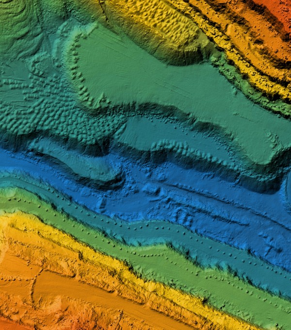
Fine-scale elevation, and the derivative quantity of slope, can be crucial in estimating the runoff potential of a field and determining where water is likely to pool. GEMS has projected the Digital Elevation Map (DEM) for the state of Minnesota from MnGeo onto the GEMS Grid at 1 m resolution. While this data dates back to 2008-2012, we are actively involved in discussions to set up storage for the voluminous new generation of LiDAR point clouds for MN, and plan to offer a new DEM product as soon as it is available.

GEMS Landcover - USGS Landuse on the GEMS Grid.

Spatially-aware crop modeling invariably requires information on actual area farmed, lakes and streams, forested area, etc. A snapshot in time is useful, but it is also critical to know how this land use changes over time. While there are many Landcover/landuse maps available out there, the USGS provides two US maps in particular that are updated on a frequent basis: (1) the National Land Cover Database (NLCD) and (2) Land Change Monitoring, Assessment and Projection (LCMAP). We provide both of these products, normally distributed via different projections (Albers Conical Equal Area & WGS84 Albers, respectively), consistently on the GEMS Grid.

GEMS Market Access - Global accessibility indicators.

GEMS offers queryable access to the Nelson et al. (2019) suite of global accessibility indicators. The GEMS Market Access API includes twelve (12) data layers representing estimates of the fastest ground travel times (via roads and paths) from every 1km pixel to urban clusters of varying sizes ranging from 5,000 to 50 million people. The API also includes five (5) data layers representing travel times to global ports. Such estimates can be used to (i) better understand the ground logistics of access to resources, services, and opportunities, (ii) assess the effects of those logistic realities on a host of economic decisions (i.e., moving agricultural inputs to farms or farm outputs to markets), and (iii) provide a baseline for sustainable development decisions and agri-food market chain initiatives.

GEMS Biotic Threats - Gridded spatial risk geographies.

Biotic threats cause considerable damage both to agricultural and natural systems. The risk measures accessible through this API reflect the climate suitability of global locations for important biotic threats. Climate suitability data on these biotic threats is central  to developing  strategies to mitigate or prevent crop losses that have significant food security, biodiversity, or societal health consequences. This API  provides pest risk researchers and other end users with access to GEMS gridded spatial risk geographies for 24 pests, weeds, or pathogens deemed of high risk for maize, wheat, cassava and other economically important crops.

GEMS Climate - Past and future views of global climate

Climate shapes the type of crops and their productivity throughout the world. GEMS climate brings together numerous variables from leading global climate data publications. Future additions will include high-resolution climate change projections for Minnesota.

GEMS Exchange API's Case Studies, See our Services in Action